Before 1700: Earth Science's Global, Unsung Origins
Earth science didn't start in 18th-century Europe. Before the 1700s, no single field combined geology, oceanography, and meteorology.
Earth Science: A Global Story
Earth science did not begin in 18th-century Europe. For centuries, people worldwide explored our planet. They laid groundwork for all that came after.
Earth science investigates our planet’s physical structure, processes, and past. It includes geology, oceanography, and meteorology. Its purpose is to understand how Earth works. Before the 1700s, no single field combined these studies.
Instead, cultures worldwide observed Earth’s phenomena independently. Philosophers, scholars, and workers across continents asked these questions. They sought answers from pure curiosity or urgent need for resources. This early work formed the basis for later organized study.
Earth Science Did Not Start in One Place
Many stories call James Hutton the “Father of Modern Geology.” His Theory of the Earth (1788) introduced uniformitarianism, a key idea. This concept states that Earth’s geological processes work today as they did in the past. It changed how people viewed geological time.
Ancient civilizations understood much about Earth processes. They wove these observations into their philosophies and daily work. Their contributions were not always formal “science,” but they were systematic. Focusing only on 18th-century Europe minimizes these earlier, deep understandings.
For example, the ancient Greek philosopher Aristotle wrote about climate and geology. His Meteorologica appeared around 350 BCE. He discussed earthquakes, floods, and land changes. His work shows early attempts to categorize and explain natural events. This occurred over 2,000 years before the European Enlightenment.
More Than Just Europe
Advanced Earth study is not purely Western and post-Renaissance. Other cultures made significant, often overlooked, advancements. These contributions provide important context for the field’s worldwide growth.
In the 11th century, Persian scholar Avicenna wrote The Book of Healing. This book contained detailed sections on geology and Earth processes. Avicenna described mountains forming from collected sediment and erosion. This was a remarkably modern idea. His work influenced European thinkers centuries later.
China also has a long history of Earth observation. The scholar Shen Kuo, in his Dream Pool Essays around 1088 CE, documented fossilized shells in inland mountains. He correctly deduced these areas were once ancient seashores. Shen Kuo also observed petrified bamboo in dry northern climates. He thus understood past climate changes. This evidence directly challenged static views of Earth’s surface.
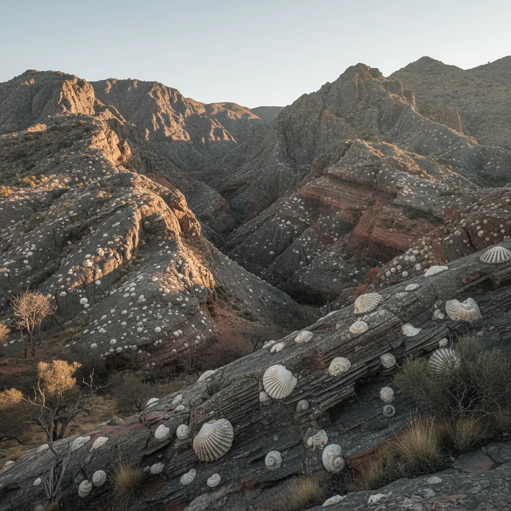
Around 1088 CE, Chinese scholar Shen Kuo documented fossilized shells found in inland mountains, correctly deducing these areas were once ancient seashores. This observation provided early evidence of Earth's dynamic geological history, centuries before similar ideas gained traction in Europe. (AI-generated illustration)
Ancient Roman geographer Strabo explored volcanism and landform changes. His Geographica appeared around 7 BCE – 23 CE. He described earthquake effects and discussed how islands form. Strabo’s detailed observations across the Mediterranean basin demonstrated early field geology. These examples confirm a long, widespread history of Earth study.
Industry Drove Early Geology
Many credit academic research with powering early geological mapping. Intellectual curiosity was important. However, economic need often drove these advances. The constant search for resources, especially minerals, pushed practical geological knowledge forward. This practical drive often came before formal science theory.
Georgius Agricola’s De re metallica, published in 1556, shows this industrial influence. This detailed book on mining and metallurgy described rock layers, mineral veins, and ore deposits. Agricola carefully outlined geological formations important for mining. His work offered a practical, systematic way to explore underground.
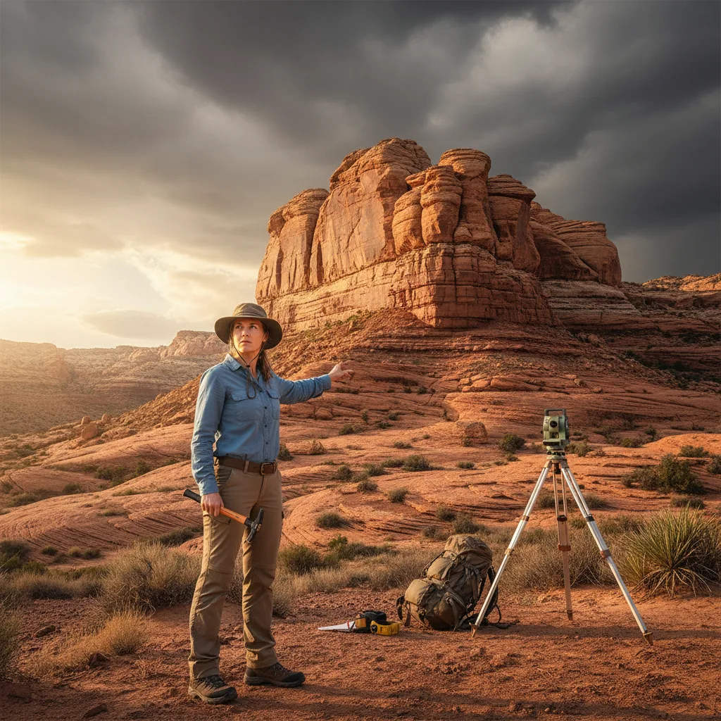
Mining engineers and surveyors in the 1600s and 1700s made detailed local maps. These maps charted geological features to find valuable ores. These practical efforts greatly aided understanding of stratigraphy. They mapped rock layers and their relationships long before academic geology was widespread. William Smith’s work in England in the late 1700s directly illustrates this. Smith, a canal surveyor, produced the first full geological map of England in 1815. His work mapped coal seams.
The Industrial Revolution’s demand for coal and metals directly accelerated geological research. It funded expeditions and encouraged new mapping techniques. This economic driver was a powerful, often overlooked, force in early Earth science. It provided the data and motivation that theoretical geology later organized.
Continental Drift: An Old Idea
The idea that continents move across Earth’s surface often seems like a groundbreaking 20th-century concept. Alfred Wegener’s 1912 proposal of continental drift is often cited as its origin. His theory, detailed in The Origin of Continents and Oceans (1915), presented strong evidence. This included the “jigsaw fit” of continents, matching fossils, and similar rock types across oceans.
The idea of continents shifting was not entirely new. Abraham Ortelius, a Flemish cartographer, noticed the obvious fit of the Americas with Europe and Africa in 1596. He even suggested the Americas were “torn away” from Europe and Africa. This observation appeared in his Thesaurus Geographicus. Ortelius guessed huge disasters caused such a separation.
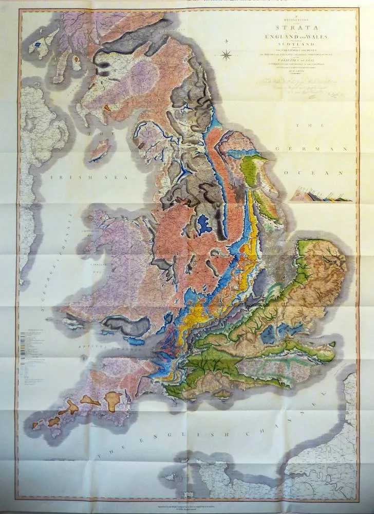
William Smith's groundbreaking 1815 geological map of England and Wales, often called 'the map that changed the world,' was the first to show the geological structure of an entire country. This monumental achievement, born from Smith's practical work as a canal surveyor, directly illustrates how economic needs in mining and engineering drove early geological advances. (Source: geolsoc.org.uk)
Later, Antonio Snider-Pellegrini proposed land bridges and continental separation in 1858. He presented maps showing the Americas and Africa joined. Snider-Pellegrini used geological evidence from fossil plants to support his claims. These early ideas, though lacking a mechanism, show a long-held observation. They demonstrate that Wegener built on centuries of scattered ideas.
Wegener’s major contribution was combining varied evidence into a clear hypothesis. His challenge was not observing the fit. Instead, it was proposing a believable force. The scientific community initially rejected his theory. They demanded a mechanism powerful enough to move continents.
Plate Tectonics: How it Really Happened
Broad acceptance of continental drift, renamed plate tectonics, often credits a few leading male geophysicists in the 1960s. This view acknowledges their important work. However, it often overlooks key contributions. It also minimizes the role of military technology and diverse researchers. The Cold War, specifically, played an unexpected part in its eventual acceptance.
During the 1950s, widespread sonar mapping of the ocean floor occurred. Military interest in submarine warfare largely drove this. This mapping revealed the worldwide system of mid-ocean ridges and deep-sea trenches. Bruce Heezen and Marie Tharp, working at Columbia University, created the first full map of the ocean floor in 1957. Tharp’s careful interpretation of sonar data identified the Mid-Atlantic Ridge and its central rift valley. This was a key piece of evidence, pointing to a spreading mechanism.
Harry Hess, a Princeton geologist and naval officer, proposed the idea of seafloor spreading in 1960. He suggested new crust forms at mid-ocean ridges and moves outwards. This provided the long-sought mechanism for continental movement. Later work by Fred Vine, Drummond Matthews, and Lawrence Morley in 1963 confirmed Hess’s idea. They showed magnetic striping on the seafloor correlated with reversals of Earth’s magnetic field. This confirmed the continuous creation of new crust.
Plate tectonics did not appear as a sudden, single discovery. It was a complex result of centuries of observation. It required decades of data collection, much of it for non-scientific purposes. The contributions of cartographers, women scientists, and military funding were essential. Popular accounts often downplay these elements.
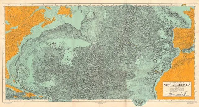
Geologist and cartographer Marie Tharp, often overlooked, meticulously interpreted sonar data to create the first comprehensive map of the ocean floor in 1957. Her work, especially the identification of the Mid-Atlantic Ridge and its central rift valley, provided crucial evidence for seafloor spreading and the theory of plate tectonics. (Source: blog.geogarage.com)
Our Changing Planet, Future Study
Earth science keeps changing, building on this deep and varied groundwork. Modern techniques, like satellite remote sensing and seismic imaging, offer new levels of detail. These tools allow us to watch Earth’s systems in real-time. They show the complex links between our planet’s atmosphere, oceans, and solid interior.
Today’s research extends beyond Earth, into planetary science. Understanding Earth’s history helps us interpret geological processes on other planets. The US Geological Survey (USGS) plays a key role in mapping and understanding these processes. Their work ranges from watching volcanoes to evaluating water resources.
Earth science’s future needs ongoing collaboration across fields. It requires combining different data sets, from ancient ice cores to real-time seismic networks. We are always building on a worldwide legacy of curiosity and observation. The planet’s story is still unfolding. Our collective efforts will continue to understand it.
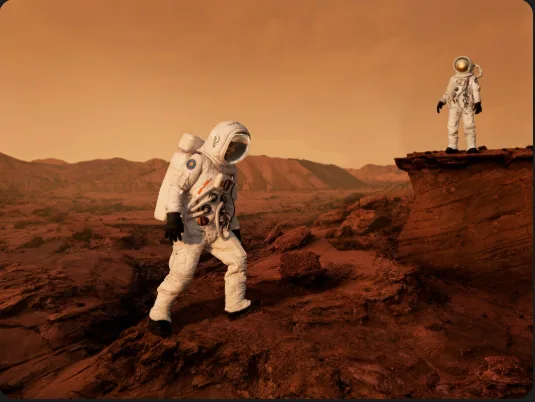
The surface of Mars, captured by a rover, reveals geological features such as ancient riverbeds or volcanic plains. Studying these formations helps planetary scientists understand Earth's own geological history and the potential for life beyond our planet. (Source: telescopegeek.com)
You might also like:
👉 Significant Medical Breakthroughs: A Journey Through Medicine History
👉 Super El Niño 2026 Predictions: Global Impact & What to Expect