1960's TIROS-1: The Satellite That Showed Earth's Climate
On April 1, 1960, TIROS-1 launched from Cape Canaveral, giving humanity its first global look at Earth's weather. Discover how this pioneering satellite shaped our understanding of climate.
Our view from space: Earth’s climate future
Imagine seeing Earth’s weather from space for the first time. On April 1, 1960, a cylindrical spacecraft named TIROS-1 launched from Cape Canaveral. It carried two cameras. Its simple mission: photograph Earth’s cloud cover from orbit. Few people then understood its significance. This satellite gave us humanity’s first global look at our planet’s weather.
Before TIROS-1, understanding Earth’s huge climate system depended on scattered ground stations. Scientists like Dr. Charles Keeling began measuring atmospheric carbon dioxide in 1958. His daily readings from Mauna Loa, Hawaii, showed a steady rise. Early climate models, like those developed by Syukuro Manabe and Richard Wetherald in the 1960s, predicted global warming from CO2. Still, no one had complete global data. The planet was too large, its processes too complex, for ground-based observation alone. This showed an urgent need for a broader view, one only space could provide.
Eyes in the sky: a global view
TIROS-1’s launch marked a big change. For the first time, scientists could watch weather systems develop across entire continents. This early success pushed more development. It showed the great potential of space observation.
On July 23, 1972, NASA launched Landsat 1. This was the first Earth-observing satellite dedicated to land resources. It orbited 900 kilometers above the planet. Landsat 1 captured detailed images of forests, agricultural fields, and urban growth. These images gave us important data on changing land use. Scientists began tracking deforestation and urban sprawl on a scale previously impossible.
Over the next decades, many satellites followed. They measured different parts of Earth’s system. Nimbus 7, launched in 1978, carried instruments to watch ozone levels. It detected the Antarctic ozone hole in the mid-1980s. This discovery, made by Dr. Joseph C. Farman’s team, shocked scientists. It showed humanity’s unexpected impact on the atmosphere.
By the late 1980s, these early satellites gave us an incomplete but expanding view. They showed changes in ice cover, vegetation, and atmospheric composition. This new data helped refine climate models. It confirmed that human activities were altering the planet. The message was clear: a global, unified monitoring system was urgently needed.
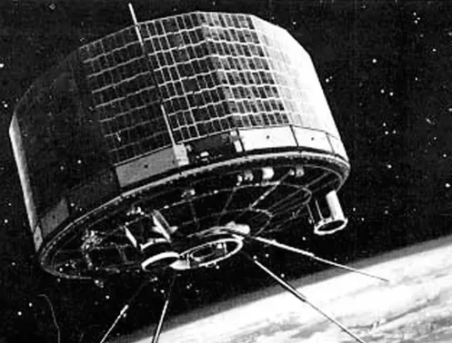
Launched on April 1, 1960, TIROS-1 was the world's first successful weather satellite. It provided humanity's initial global view of Earth's cloud cover, marking a pivotal moment in meteorology and the dawn of space-based climate observation. (Source: nesdis.noaa.gov)
The climate crisis: space data confirms it
The 1990s brought a new era of precise climate monitoring from space. Missions became more specialized, focusing on key climate indicators. On August 10, 1992, the TOPEX/Poseidon satellite launched. This joint U.S.-French mission precisely measured sea surface height. Its data greatly advanced oceanography.
TOPEX/Poseidon and its successors, like Jason-1, showed a consistent rise in global sea levels. They recorded an average increase of 3.4 millimeters per year, as confirmed by NASA’s Jet Propulsion Laboratory. This data gave clear evidence of ocean warming and melting ice sheets. Scientists like Dr. Josh Willis used this information to track ocean heat content. They linked it directly to thermal expansion.
Other missions gave valuable information into Earth’s cryosphere. The Gravity Recovery and Climate Experiment (GRACE) satellites, launched in 2002, measured changes in Earth’s gravity field. These tiny shifts showed movements of mass. Scientists used GRACE data to track the melting of ice sheets in Greenland and Antarctica. They also watched changes in groundwater storage. Dr. Isabella Velicogna at the University of California, Irvine, used GRACE data. Her work showed accelerating ice loss from polar regions.
The Moderate Resolution Imaging Spectroradiometer (MODIS) instruments, on NASA’s Terra and Aqua satellites (launched 1999 and 2002), provided daily global coverage. They monitored vegetation health, wildfires, and changes in land cover. Dr. Steven Running, a lead scientist for MODIS, used its data to track global primary productivity. He found shifts in growing seasons and increased drought stress in many regions. Space data became the foundation of international climate assessments. It moved climate change from a theory to an observed, measurable reality. This evidence formed the basis for global climate policy discussions.
Beyond observation: space tech for climate solutions
Today, space technology moves beyond just watching. It offers tools for direct climate action and mitigation. Satellites now pinpoint sources of greenhouse gas emissions. This helps enforce environmental rules. It also guides specific efforts to reduce emissions.
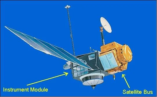
Launched in 1992, the TOPEX/Poseidon was a pioneering U.S.-French satellite mission that precisely measured sea surface height. Its data greatly advanced oceanography and provided crucial evidence of global sea level rise, a key indicator of climate change. (Source: eoportal.org)
On October 13, 2017, the Copernicus Sentinel-5P satellite launched. This mission, part of the European Union’s Copernicus program, watches atmospheric composition. It tracks pollutants like methane, nitrogen dioxide, and carbon monoxide. Sentinel-5P can identify methane super-emitters, often from oil and gas infrastructure. This detailed data allows governments and companies to address specific leaks.
Private companies also join this effort. GHGSat, a Canadian company, launched its first satellite, GHGSat-D, in 2016. Its satellites track methane emissions from industrial sites globally. Stephane Germain, CEO of GHGSat, emphasizes its role in corporate accountability. This technology provides independent verification of emissions reductions. It holds polluters responsible.
Future space technologies promise even more direct actions. Satellite data already improves precision agriculture. It makes water use and fertilizer application better. This reduces agricultural emissions. Researchers also explore space-based solar power. This could beam clean energy to Earth. Other ideas involve watching potential geoengineering efforts. These might try to cool the planet. Space exploration, once mainly for science, now offers direct ways to act. The result is that space science and Earth’s environmental management are becoming one.
The carbon cost of reaching for the stars
Space offers climate solutions, but the industry itself leaves an environmental footprint. Rockets burn propellants, releasing gases into the air. Making satellites also uses resources and energy. This raises questions about how sustainable space exploration truly is.
A single large rocket launch, like the SpaceX Falcon 9, burns tons of fuel. This releases carbon dioxide, water vapor, and black carbon into the upper atmosphere. Black carbon, or soot, worries scientists. It can absorb sunlight and warm the stratosphere. A 2022 study published in Earth’s Future estimated that black carbon from rocket launches could contribute to stratospheric warming. This warming might also deplete the ozone layer.
More launches, especially from commercial space companies, make this issue worse. SpaceX alone conducted 98 orbital launches in 2023. These launches have a cumulative effect. Making satellites also involves energy-intensive processes. These include mining rare earth minerals and fabricating complex electronics. Getting rid of defunct satellites adds to the problem. They become space debris, a threat to operational missions. Some debris eventually re-enters Earth’s atmosphere.
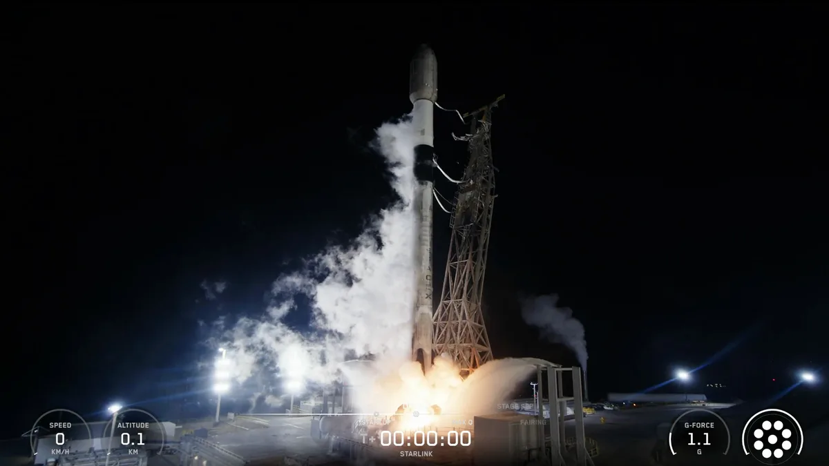
The SpaceX Falcon 9, a workhorse of commercial spaceflight, is a powerful symbol of humanity's reach for the stars. However, a single launch burns tons of fuel, releasing carbon dioxide, water vapor, and black carbon into the upper atmosphere, contributing to stratospheric warming and ozone depletion. (Source: space.com)
The space industry knows about these concerns. Many companies and agencies invest in greener technologies. Arianespace, for example, explores sustainable propellants for future rockets. They focus on reusable rockets to reduce manufacturing impacts. Researchers also develop more efficient satellite designs. They aim to minimize waste and make satellites last longer. The space industry faces growing pressure. It must balance scientific advancement and climate solutions with its own ecological responsibility.
FAQ
Q1: How do satellites measure climate change? Satellites use different sensors to watch Earth. They measure sea level, ice sheet thickness, atmospheric gases, and surface temperatures. This data helps track changes in the climate system.
Q2: Is space exploration a major contributor to global emissions? No, not currently. Rocket launches contribute a small fraction of global greenhouse gas emissions. But the rapidly increasing launch rate worries people about localized impacts.
Q3: Can space technology help us reverse climate change? Space technology mainly provides data for informed decisions. It can also help with solutions like precision agriculture. Reversing climate change needs global policy changes and action on Earth.
Q4: What’s the future of space and climate action? Future missions will offer more detailed climate data. They will track specific emissions more precisely. International collaboration will likely increase. Space will play an important role in checking climate actions.
Earth’s future in the cosmic mirror
The journey from TIROS-1 to today’s advanced climate observatories shows an important lesson. Space exploration changed our understanding of Earth. It provided clear evidence of a changing climate. Today, it offers powerful tools for mitigation and adaptation.
Future missions will keep refining our global climate picture. New satellites will pinpoint even smaller emissions sources. They will watch important ecosystems with never-before-seen detail. The Earth System Observatory program, planned by NASA, will integrate multiple missions. It aims to provide a complete view of Earth’s linked systems. This will inform future policy decisions.
The space industry itself will also change. It will develop greener fuels and more sustainable practices. Reusable rockets and satellite recycling will become standard. Humanity’s reach for the stars will continue. It will do so with a deeper awareness of its responsibilities to the planet below. Our view from space is vital for Earth’s future.
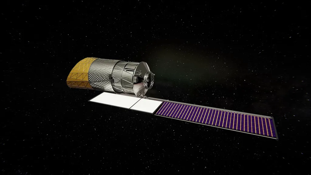
NASA's Earth System Observatory is an ambitious planned program comprising a new architecture of integrated satellites and instruments. It aims to provide a holistic, 3D view of Earth's interconnected systems, from atmosphere to bedrock, delivering critical data to inform future climate action and policy. (Source: svs.gsfc.nasa.gov)
You might also like:
👉 The $546 Billion Space Race: Private Money, Global Rivalries